
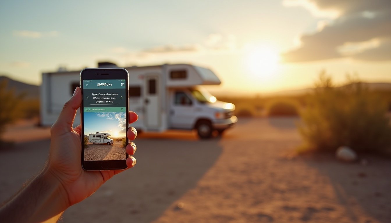
Travelling Australia by RV is one of the most rewarding ways to explore the country’s vast coastlines, remote outback tracks, and vibrant regional towns. But as liberating as life on the road can be, it also comes with its fair share of challenges — from finding reliable fuel stations and affordable campsites to dodging road closures, locating dump points, and maintaining internet access in remote regions.
That’s where the power of mobile apps comes in.
In today’s connected world, a well-curated collection of travel apps can transform your RV trip into a smoother, safer, and more enjoyable adventure. The right tools can help you:
Avoid overpriced fuel stops
Discover free or off-grid campsites
Navigate without mobile reception
Track expenses and stay on budget
Get real-time weather and emergency updates
Stay connected with offline maps and satellite internet
This guide lists the top RV travel apps for Australia, handpicked specifically for motorhome, campervan, and caravan travellers. Whether you’re navigating the Nullarbor, hugging the Great Ocean Road, or free camping in the Far North, these apps will help you save time, reduce fuel costs, and avoid common roadtrip hassles.
Let’s dive in and build the ultimate digital toolkit for your next Aussie RV adventure.
Table of Contents
ToggleBest Navigation & Mapping Apps for RVers
When you’re towing a caravan or navigating unfamiliar highways in a motorhome, reliable navigation is non-negotiable. But not all map apps are created equal — some shine in metro traffic, others are built for remote outback tracks or large vehicle considerations. Here are the top navigation apps every Australian RV traveller should consider:
1. Google Maps
Best for: General navigation, real-time traffic, and satellite imagery
Google Maps is a go-to for millions of travellers worldwide, and for good reason. It offers turn-by-turn directions, traffic updates, road closures, and alternative routes. Its satellite view is especially helpful for checking the layout of campsites, caravan park entrances, and parking areas for large rigs.
Key Features:
Live traffic and rerouting in real time
Street View helps visualise tricky park entries or fuel stops
Vast point-of-interest data: cafes, fuel, supermarkets, etc.
Works offline with downloaded maps
Limitations:
Doesn’t offer RV-specific route planning (e.g., height/weight limits)
Can occasionally redirect you down tight urban roads — use caution in cities
Tip: Use satellite mode before arriving at a campsite to see if there’s room to turn around or where the beachside sites are located.
2. Hema 4WD Maps / Hema Explorer
Best for: Off-road navigation and remote area exploration
Hema Maps has long been trusted by 4WD and adventure travellers across Australia. Their digital offering, Hema 4WD Maps and Hema Explorer, is tailored to those heading into the outback, national parks, or unsealed roads — ideal for RVers venturing beyond the bitumen.
Key Features:
Detailed topographic and 4WD maps
Offline access to huge map regions
User-added waypoints and trip logs
Campsite and point-of-interest overlays
Limitations:
Paid app — pricing varies depending on version
Less suitable for day-to-day metro driving
Ideal Use: Planning long-haul remote journeys like the Gibb River Road, Oodnadatta Track, or Cape York, especially when data is unavailable.
3. Waze
Best for: Avoiding traffic, hazards, and getting community-sourced updates
Waze is a real-time traffic app powered by its user base. It’s particularly handy in busy metro areas, helping you avoid traffic jams, roadworks, speed traps, and sudden hazards on the road.
Key Features:
Community reports on road conditions and incidents
Live police, pothole, and debris alerts
Voice navigation and ETA sharing
Often faster than Google Maps in cities
Limitations:
Not RV-specific — may suggest roads unsuitable for caravans
Requires mobile reception to work
Best Use: City driving or suburban areas where congestion or construction delays are common. Not recommended for remote or large-rig-only routes.
Top Camping & Caravan Park Finder Apps
One of the greatest freedoms of RV travel is choosing where to stay each night — from beachside resorts to remote bush camps. But finding the right spot, especially one that fits your rig, budget, and vibe, can be time-consuming without the right tools. These apps make it easy to find, compare, and choose the perfect campsite on the go.
4. WikiCamps Australia
Best for: Comprehensive camping and caravan site listings with user reviews
WikiCamps is the most widely used camping app in Australia and a must-have for any RV traveller. With a massive database covering everything from free camps and national park campgrounds to holiday parks and dump points, it’s your all-in-one resource for overnight stays.
Key Features:
Crowd-sourced listings with photos, reviews, and ratings
Filters for powered/unpowered, toilets, pets, water, etc.
Works offline after downloading maps
Includes dump points, day use areas, and caravan-friendly stops
Limitations:
Interface can feel slightly dated
Requires initial download of large offline database
Power Tip: Use filters like “free,” “maximum rig length,” and “verified photos” when planning multi-day trips off-grid.
5. CamperMate
Best for: Clean interface and ease of use for beginners
CamperMate is another highly trusted app among Aussie travellers, offering a smooth, map-based interface with accurate listings of campsites, caravan parks, amenities, and nearby services.
Key Features:
User ratings, photos, and helpful tips
Highlights petrol stations, water taps, toilets, ATMs
Seamless map interface with intuitive navigation
Also includes alerts and road warnings
Limitations:
Fewer listings in very remote or lesser-known areas
Some features require sign-in
Ideal Use: Coastal trips, short stays, or new RVers who want an easy-to-use campsite locator that covers the essentials.
6. Hipcamp Australia
Best for: Unique and private camping experiences on farms or private land
If you’re looking to get off the grid or avoid crowded parks, Hipcamp connects you with private landowners offering unique stays — from vineyard paddocks to beachfront bushland.
Key Features:
Bookable sites on private properties (often exclusive)
Filter by RV access, pet policy, amenities, campfires
Many off-grid, eco-friendly, or secluded options
Hosts often provide extras like firewood or farm tours
Limitations:
Requires online booking (not great if reception is poor)
Limited to properties registered with the app
Why Try It: Perfect for those wanting an authentic, crowd-free experience away from commercial holiday parks — especially popular among self-contained travellers.
Apps to Save Fuel & Track Costs
Fuel is one of the biggest recurring expenses for RV travellers — especially when covering long distances in a motorhome or towing a caravan. With fuel prices varying significantly between towns and states, using apps to compare prices and monitor your spending can save you hundreds of dollars over the course of a trip.
7. FuelMap Australia
Best for: Locating the cheapest fuel nearby in real time
FuelMap is a free, Australia-wide app that uses both user-submitted and government data to show fuel prices at stations near your location. It’s an essential app for long-distance RV travellers wanting to avoid inflated highway prices.
Key Features:
Interactive map of petrol stations with current prices
Filter by fuel type (unleaded, diesel, LPG, etc.)
Shows brand, address, and amenities (e.g. toilets, air)
Includes a basic fuel logbook
Limitations:
Some remote areas have fewer recent updates
Interface is functional but not flashy
Pro Tip: Check fuel trends in upcoming towns before you top up — you might save 20–30 cents per litre by driving just 15 km further.
8. GasBuddy
Best for: Tracking fuel prices across multiple countries (including Australia)
While GasBuddy originated in North America, its Australian coverage is steadily improving. It offers price alerts, historical trends, and loyalty savings in some locations.
Key Features:
Price history charts help identify cheapest times to fill up
Station amenities: restrooms, air, truck access, etc.
Price spike alerts and trending insights
Limitations:
Some stations may be missing in remote towns
Requires an account for full features
When to Use It: On cross-border or interstate trips where pricing varies by region or you want broader analytics.
9. Roadtrip Expense Tracker / Drivvo
Best for: Tracking travel budgets, fuel economy, and vehicle maintenance
These apps (Roadtrip and Drivvo are both excellent options) allow you to log each fuel stop, monitor your RV’s fuel efficiency, and track maintenance and expenses over time — especially useful for long-term or full-time travellers.
Key Features:
Log fuel fills, odometer readings, and cost per litre
Generate trip summaries and spending graphs
Track oil changes, services, tyre rotations, etc.
Export data for tax or reimbursement purposes
Limitations:
Manual data entry required (no fuel price comparison)
Best suited to those who like detailed recordkeeping
Why It’s Valuable: Helps you stay within budget, identify rising fuel consumption, and keep track of your RV’s servicing needs during long-haul journeys.
Connectivity & Offline Access Apps
Staying connected while travelling Australia in an RV isn’t always easy — especially in remote regions where mobile reception drops out. Whether you’re working remotely, keeping in touch with family, or relying on maps and bookings, these apps help you manage connectivity and stay informed even without mobile data.
10. Starlink App (for Starlink RV Satellite Users)
Best for: Managing satellite internet while off-grid
With the growing popularity of Starlink for RVs in Australia, the official Starlink app has become essential for travellers relying on satellite internet in remote areas. It allows users to monitor connection strength, reposition the dish, and test network latency.
Key Features:
View signal strength and dish alignment in real time
Map view shows obstructions (trees, buildings, etc.)
Receive notifications for outages and disconnections
Ideal for work-from-van travellers or remote content creators
Limitations:
Requires a Starlink dish and subscription
Consumes power — not ideal for minimalist setups
Best Use: Off-grid camping where mobile reception is nonexistent but internet access is needed for navigation, communication, or work.
11. OpenSignal
Best for: Checking mobile signal coverage before arrival
OpenSignal helps you test your current mobile reception and compare Telstra, Optus, and Vodafone coverage maps. It’s perfect for choosing which SIM or provider is best for the regions you’ll be travelling through.
Key Features:
Coverage heatmaps by network
Signal speed and strength testing tools
Directional compass to locate towers nearby
Helpful in identifying black spots ahead of time
Limitations:
Requires data or Wi-Fi to load maps initially
Not always accurate in newly developed areas
Pro Tip: Use it to decide whether a signal booster or switching carriers is worth the investment for your trip.
12. Pocket Earth / Maps.me
Best for: Offline navigation and map access when off-grid
Both Pocket Earth and Maps.me are excellent apps for downloading high-detail offline maps — ideal for travelling through areas without reception or where data is expensive.
Key Features:
Turn-by-turn directions without internet
Mark waypoints, campsites, and water sources
GPS-based tracking without mobile signal
Lightweight app size and battery-efficient
Limitations:
Fewer POIs than Google Maps
Limited customisation in routing
Best Use: Remote travel in regions like the Red Centre, Nullarbor, Tasmania’s West Coast, or Cape York where standard map apps stop working without mobile coverage.
Safety, Emergency & Weather Apps
Safety on the road is paramount — especially when navigating Australia’s remote regions, unpredictable weather, or bushfire-prone zones. These trusted apps keep you informed, prepared, and connected in case of emergencies, severe weather events, or changing road conditions.
13. BOM Weather App
Best for: Accurate, official weather forecasts and radar tracking
Developed by the Bureau of Meteorology, the BOM Weather app is the most reliable source of weather data in Australia. It’s a must-have for all RVers — whether you’re beach camping, crossing the Outback, or watching for coastal storms.
Key Features:
Real-time rain radar and storm tracking
Seven-day forecasts by postcode or GPS
Warnings for severe weather, marine, and fire danger
UV index, wind speed, tide charts, and sunrise/sunset times
Limitations:
Requires internet connection for updates
Interface can feel slightly technical for first-time users
Pro Tip: Set up alerts for multiple towns along your route to stay ahead of sudden weather shifts.
14. Emergency+
Best for: Fast, location-based emergency contact during incidents
Created by Australia’s emergency services, Emergency+ is a lifesaving app designed for fast response when you need help. Whether it’s a breakdown, medical emergency, or bushfire, this app sends accurate GPS coordinates to emergency responders — even when you don’t know your exact location.
Key Features:
Quick-call buttons for 000, SES, and Police
Displays your current latitude and longitude
Works with minimal reception (coordinates still load)
Ideal for solo travellers or remote trips
Limitations:
Doesn’t replace having a first aid kit or UHF radio
You must still describe your emergency to the operator
Best Use: Remote or regional camping, Outback travel, or off-grid adventures where street addresses don’t exist.
15. Fires Near Me / Hazards Near Me
Best for: Tracking bushfires, floods, and hazard zones in real time
Bushfire season is a serious concern for RVers, especially in summer and early autumn. The Hazards Near Me NSW (formerly Fires Near Me) and similar apps by other state governments help you monitor natural threats across your location or travel route.
Key Features:
Real-time fire and flood alerts
Customised warning zones via GPS
Push notifications for changing conditions
Map overlays showing fire size and containment level
Limitations:
Coverage is state-specific — download the right version (e.g., VicEmergency, QLD Fires)
Requires mobile data to function in full
Tip: Always carry a printed bushfire safety checklist in high-risk areas and have an exit route planned when staying in dense bush regions.
Apps for Dump Points, Water, and Toilets
Efficient waste disposal and access to clean facilities are essential parts of RV life. Whether you’re managing greywater, blackwater, or just need a nearby public toilet, these apps help you locate the right services with minimal hassle — especially helpful in remote regions or unfamiliar towns.
16. Toilets Australia (by the Department of Health)
Best for: Finding public toilets anywhere in Australia
Toilets Australia is an official government app listing over 19,000 public toilet facilities across the country. It’s particularly useful for travellers without onboard toilets or when travelling with kids or elderly passengers.
Key Features:
Locations of public toilets, rest areas, and accessible facilities
Filters for disabled access, baby change tables, opening hours
GPS-based directions and amenities listings
Data regularly updated by councils and state departments
Limitations:
Doesn’t include dump points for RVs
Some rural listings may lack user reviews
Ideal Use: Quick toilet stops during long-haul drives or when boondocking in towns without caravan parks.
17. Dump Point Finder (via WikiCamps)
Best for: Locating greywater and blackwater disposal stations
While there’s no standalone “Dump Point Finder” app in wide use, WikiCamps has a built-in dump point locator that’s invaluable for all RVers. You can search specifically for disposal stations near your location or along your travel route.
Key Features:
Filter map to show only dump points
Details on access hours, hose connections, and fees (if any)
User photos and tips about site cleanliness and access
Offline maps for use in remote areas
Limitations:
Some dump points may be seasonal or privately managed
Availability in very remote areas may be sparse
Pro Tip: Always carry your own gloves, rinse hose, and sanitiser — even at well-maintained facilities.
18. WaterMap (State or Council Specific Apps)
Best for: Finding potable water refill stations legally and easily
While there isn’t one universal app for water fill points across Australia, several states and local councils publish potable water maps or web-based tools. These show legal and accessible spots to refill tanks — especially important for free campers or self-contained travellers.
Where to Look:
Caravan Industry Associations (e.g., CIAA WA, VIC, QLD)
Regional council websites (e.g., Yorke Peninsula Water Map)
WikiCamps often includes water tap icons with user notes
CamperMate also lists water refill stations
Limitations:
Not always available as a standalone app
Some taps may require special connectors or have pressure issues
Best Practice: Refill before entering remote stretches. Always test for potable quality and follow signage — not all taps are drinking-safe.
Entertainment, Trip Planning & Extras
Long days on the road and quiet nights at camp are part of the RV lifestyle — and having the right apps can help fill those hours with relaxation, learning, or efficient trip organisation. Whether you’re streaming a podcast, planning your next stop, or tracking sun exposure, these extras round out your RV toolkit.
19. YouTube / Spotify / Audible
Best for: Road trip entertainment on the go (streaming or offline)
These three platforms offer endless content for solo travellers, couples, and families:
YouTube: Travel vlogs, campsite walkthroughs, RV tutorials
Spotify: Music playlists, roadtrip soundtracks, travel podcasts
Audible: Audiobooks for immersive storytelling during long drives
Key Features:
Download content for offline use (essential for blackspot zones)
Personalised suggestions and trending playlists
Accessible on phones, tablets, or car infotainment systems
Tips for RVers:
Download episodes or albums in areas with strong signal
Use Bluetooth or AUX to play audio through your RV sound system
Create a shared playlist for family trips or solo journaling
Bonus Idea: Follow Aussie RV YouTubers or podcast channels for inspiration, tips, and campsite reviews.
20. Google Drive / Notion / Evernote
Best for: Planning itineraries, storing documents, and syncing info
Digital organisation tools like Google Drive, Notion, and Evernote help you:
Plan routes, track bookings, and manage documents
Store scans of your license, registration, insurance, roadside assistance, etc.
Collaborate with travel companions or backup info across devices
Key Features:
Cloud storage with offline access options
Notes, checklists, spreadsheets, or itinerary templates
Syncs across laptop, mobile, and tablet
Why It Matters: If you lose paperwork or need to share trip details quickly, these apps can be a lifesaver — especially in emergencies or when dealing with rentals, authorities, or breakdowns.
21. SunSmart App
Best for: Managing sun exposure and protecting skin during outdoor travel
Created by Cancer Council Australia, the SunSmart App is essential for any Aussie roadtripper spending time outdoors. It helps you understand UV levels and take action to reduce the risk of sunburn or long-term skin damage.
Key Features:
Live UV index by location
Alerts for when sun protection is needed
Sun safety tips for adults and kids
Location-specific sunrise/sunset times
Limitations:
Needs internet for live updates
Doesn’t cover every rural region perfectly
Best Use: When hiking, beach camping, or driving in exposed areas. It’s also helpful for planning shade times, kids’ outdoor play, or when to reapply sunscreen.
How to Choose the Right Apps for Your RV Trip
With dozens of RV travel apps available — each offering different features, coverage, and use cases — it’s important to tailor your digital toolkit to your travel style, destination, and level of self-sufficiency. Here’s how to choose the best combination of apps without cluttering your phone or wasting data.
1. Identify Your Travel Needs
Start by assessing the type of RV trip you’re planning:
Off-grid & remote: Prioritise offline maps (Hema, Maps.me), fuel tracking (FuelMap), dump/water finders, and satellite connectivity (Starlink).
Holiday parks & powered sites: Focus on campsite finders (WikiCamps, CamperMate), booking platforms (Hipcamp), and navigation apps (Google Maps).
Budget-conscious: Add apps for fuel comparison, free camps, and trip expense trackers (Drivvo, Roadtrip).
The more independent and remote your travel, the more important offline and self-contained tools become.
2. Combine Apps for Redundancy & Flexibility
No single app covers everything. A smart strategy is to pair complementary tools:
Navigation: Use Google Maps for general driving + Hema for remote tracks
Campsites: WikiCamps for detail + CamperMate for simplicity + Hipcamp for unique stays
Fuel & costs: FuelMap for finding the best price + Drivvo for logging every dollar spent
This gives you coverage across weak points — especially useful when one app lacks data in a specific region.
3. Test & Download Apps Before Going Off-Grid
Before leaving mobile reception:
Download offline maps and campsite databases
Create folders for each app category (Maps, Fuel, Safety, etc.)
Check storage size — some offline maps are several GB
Test each app at home so you’re not learning under pressure on the road
4. Mind Your Data, Battery, and Storage
Some apps are data- or battery-intensive. Plan ahead:
Disable auto-sync for cloud apps when not needed
Close background apps to preserve battery
Carry a power bank or inverter for off-grid charging
Use offline-first apps where possible to conserve mobile data
5. Stay Updated — But Not Mid-Trip
App updates can bring improvements but may also change interfaces or reset preferences. Update major apps before a trip, not during — especially if relying on offline maps or saved data.
Conclusion
In the ever-evolving world of RV travel, the right apps can make the difference between a stressful road trip and a seamless, rewarding adventure. Whether you’re navigating remote highways, hunting for hidden free camps, managing fuel costs, or checking weather and bushfire alerts, these digital tools put essential information at your fingertips.
Rather than relying on memory or last-minute decisions, smart RVers are now planning their journeys with the help of offline maps, campsite databases, fuel trackers, emergency tools, and trip organisers. With just a few taps, you can avoid expensive detours, find the best-value fuel, locate the nearest dump point, or stream your favourite podcast under the stars.
As a final takeaway:
Download your must-have apps before heading off-grid
Test your favourites on short trips first
Use a mix of apps for navigation, camping, safety, and entertainment
And always keep your devices charged and updated
Australia is vast, wild, and breathtaking — and with the right apps in your digital glovebox, you’ll be more prepared, more efficient, and free to enjoy every kilometre of your journey.